Now open.
Providing a route under the main station and secure bike parking.
Created using the planned but unused car tunnels.

Now open.
Providing a route under the main station and secure bike parking.
Created using the planned but unused car tunnels.
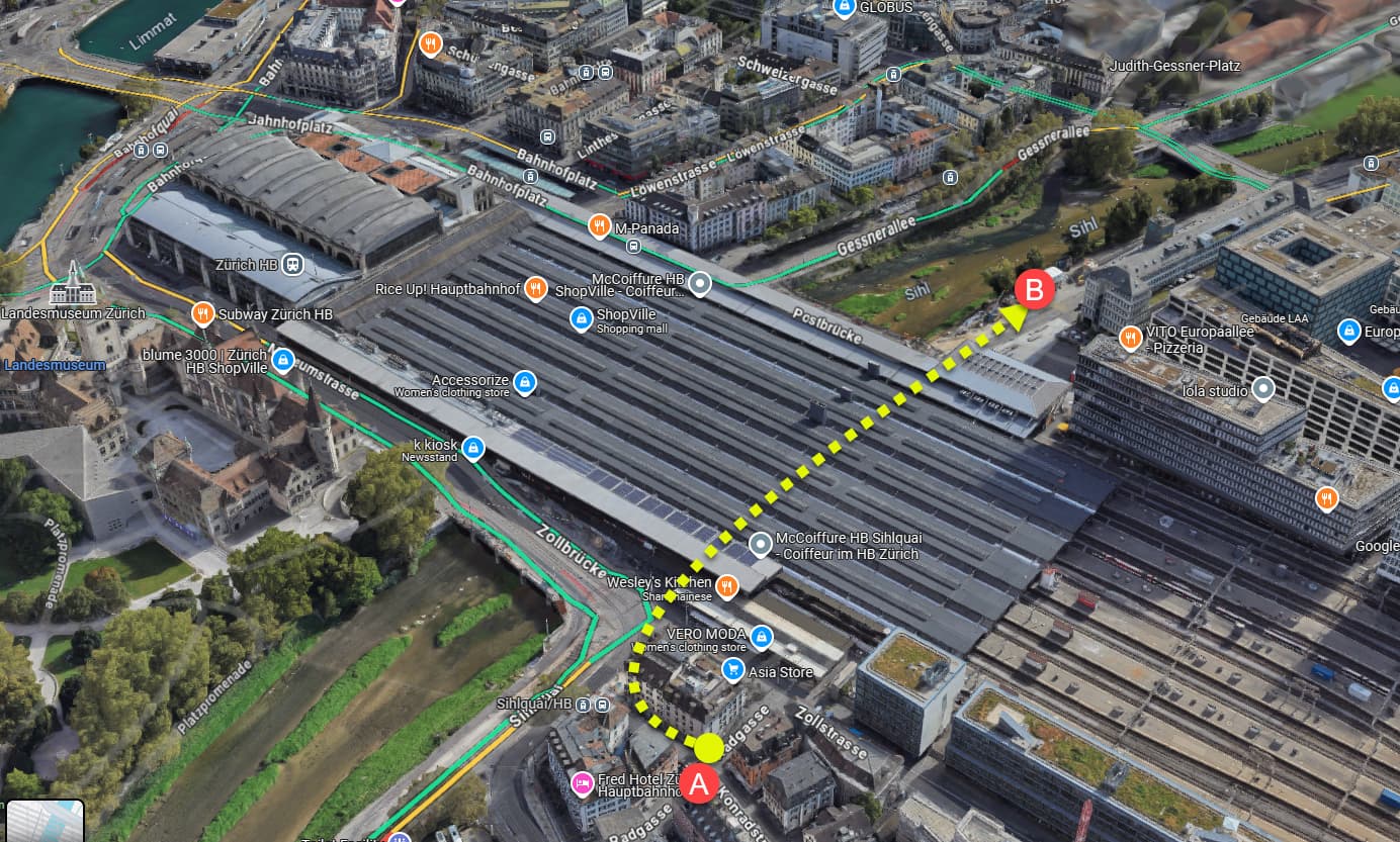
The video offers unfortunately poor geographic orientation. This might help, with the video starting at point A and finishing near B
The tunnel saves an annoying ride around the terminal end of HB or dealing with Langstrasse.
Thanks! That was exactly what I was looking for!
TBH, it would have made sense to have put a car tunnel under the bike tunnel. Too late now.
The government rejected the plans for a car tunnel in the first place. The cycle tunnel is using infrastructure already there.
The original plan was to link all three main road routes in to Zurich with a Y-section.
But why one would encourage through-traffic through the centre of a congested city?
Anyway, the Zurich by-pass network under and around Uetliberg has made it easier for people to by-pass Zurich rather than go through it.
The infrastructure is still there (the tunnel) if the road scheme gets the go-ahead in the future although I suspect by the time that debate comes around again, cars, and the way we use them today will be very different.
That was the motorway-Y plan in the 70s. Nobody ever wanted to merge all through traffic in the city center as such.
That was exactly what they wanted to do. Going through Zurich was inevitable. There was no easy way around.
From my link above:
Hardturm, Letten, Wiedikon: the city of Zurich has three motorway exits, one to the west, the other to the north, and the other to the south. While these are only a few kilometers apart as the crow flies, they are separated by numerous buildings, roads, tram lines, railways, and the main station. Two rivers also flow through the city, the Limmat and the Sihl. A symbol of prosperity in the post-war period, the plan to unite the three national roads in such a densely populated area is difficult to imagine today.
The current situation of motorway exits, however, dates back to the project to build a Y-shaped express road link through Zurich (hence the name “Y-route”). The plans date back to the 1960s. The construction project, which aimed to relieve the city of both through and intra-city traffic, was approved by the Federal Council in 1962. Its development continued in the following years.
There was a plan to have the three motorways intersect at Letten. Would have beem a gigantic concrete monster as one can see from the existing motorway bridge along the Sihl. But it would have been a separated motorway section, and not put the traffic through the center as such (as in using roads in the center). That was designed for transit at a time when neither Nord- nor Westumfahrung existed.
Anyway, that bike tunnel is cool.